Doručenie
Nákupný poradca


Nehodí sa? Žiadny problém! U nás môžete do 30 dní vrátiť
 Darčekový poukaz
v ľubovoľnej hodnote
S darčekovým poukazom nešliapnete vedľa. Obdarovaný si za darčekový poukaz môže vybrať čokoľvek z našej ponuky.
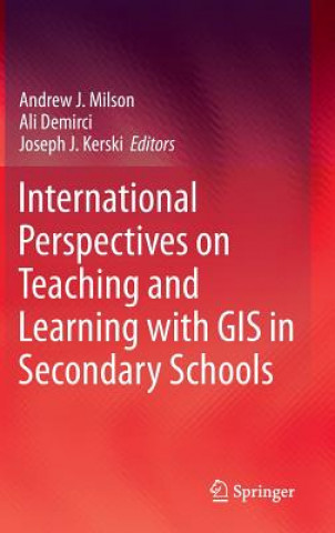
International Perspectives on Teaching and Learning with GIS in Secondary Schools
 Angličtina
 304 b
304 b
30 dní na vrátenie tovaru
Mohlo by vás tiež zaujímať


This, the first publication to collate a broad international perspective on the pedagogical value of GIS technology in classrooms, offers an unprecedented range of expert views on the subject. Geographic Information Systems (GISs) are now ubiquitous and relatively inexpensive. They have revolutionized the way people explore and understand the world around them. The capability they confer allows us to capture, manage, analyze, and display geographic data in ways that were undreamt of a generation ago. GIS has enabled users to make decisions and solve problems as diverse as designing bus routes, locating new businesses, responding to emergencies, and researching climate change. GIS is also having a major impact in the classroom. Students and teachers around the world are using this significant emerging technology in the secondary school classroom to study social and scientific concepts and processes, to broaden their technical skills, and to engage in problem solving and decision making about local and global issues.§International Perspectives on Teaching and Learning with GIS in Secondary Schools brings together authors from 34 countries who profile the current status of GIS in secondary school teaching and learning in their country. Each chapter includes a summary of the country s educational context, a case study illustrating how GIS is used in secondary schooling, and an assessment of the opportunities and challenges in teaching and learning with GIS now and in the future. The book demonstrates that GIS is not only a technological tool to be used in the classroom, but also a catalyst for motivation, encouragement, and cooperation in understanding and solving global problems.§The most up to date and extensive survey of GIS in the secondary education landscape, covering both principles and practice.§Professor David Maguire, Pro-Vice-Chancellor, Birmingham City University, UK§International Perspectives on Teaching and Learning With GIS in Secondary Schools is a highly relevant, critically important, reflective contribution to the literature, providing strong arguments supporting the inclusion for spatial studies for all in secondary school education. §Karl Donert, President, EUROGEO§This is an invaluable and inspirational examination of innovation in geospatial technologies in secondary schools around the world. Each chapter contains practical models for how to integrate powerful tools for spatial analysis into a range of subjects. It will be useful to classroom teachers and administrators seeking pathways to implementation and teacher educators considering how to prepare the next generation to use geospatial technologies.§Sarah Witham Bednarz, Department of Geography, Texas A&M University, College Station, TX, USAThis, the first publication to collate a broad international perspective on the pedagogical value of GIS technology in classrooms, offers an unprecedented range of expert views on the subject. Geographic Information Systems (GISs) are now ubiquitous and relatively inexpensive. They have revolutionized the way people explore and understand the world around them. The capability they confer allows us to capture, manage, analyze, and display geographic data in ways that were undreamt of a generation ago. GIS has enabled users to make decisions and solve problems as diverse as designing bus routes, locating new businesses, responding to emergencies, and researching climate change. GIS is also having a major impact in the classroom. Students and teachers around the world are using this significant emerging technology in the secondary school classroom to study social and scientific concepts and processes, to broaden their technical skills, and to engage in problem solving and decision making about local and global issues.§International Perspectives on Teaching and Learning with GIS in Secondary Schools brings together authors from 34 countries who profile the current status of GIS in secondary school teaching and learning in their country. Each chapter includes a summary of the country s educational context, a case study illustrating how GIS is used in secondary schooling, and an assessment of the opportunities and challenges in teaching and learning with GIS now and in the future. The book demonstrates that GIS is not only a technological tool to be used in the classroom, but also a catalyst for motivation, encouragement, and cooperation in understanding and solving global problems.§The most up to date and extensive survey of GIS in the secondary education landscape, covering both principles and practice.Professor David Maguire, Pro-Vice-Chancellor, Birmingham City University, UK§International Perspectives on Teaching and Learning With GIS in Secondary Schools is a highly relevant, critically important, reflective contribution to the literature, providing strong arguments supporting the inclusion for spatial studies for all in secondary school education. §Karl Donert, President, EUROGEO§This is an invaluable and inspirational examination of innovation in geospatial technologies in secondary schools around the world. Each chapter contains practical models for how to integrate powerful tools for spatial analysis into a range of subjects. It will be useful to classroom teachers and administrators seeking pathways to implementation and teacher educators considering how to prepare the next generation to use geospatial technologies.§Sarah Witham Bednarz, Department of Geography, Texas A&M University, College Station, TX, USA
Informácie o knihe
 Angličtina
Kategórie


 Ako nakupovať


