Doručenie
Nákupný poradca


Nehodí sa? Žiadny problém! U nás môžete do 30 dní vrátiť
 Darčekový poukaz
v ľubovoľnej hodnote
S darčekovým poukazom nešliapnete vedľa. Obdarovaný si za darčekový poukaz môže vybrať čokoľvek z našej ponuky.
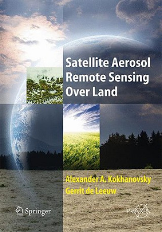
Satellite Aerosol Remote Sensing Over Land
 Angličtina
 603 b
603 b
30 dní na vrátenie tovaru
Mohlo by vás tiež zaujímať


The book opens with a description of aerosol retrievals from satellite radiometers and then looks at the 12-year record of global aerosol properties from Along-track Scanning Radiometer (ATSR-2) and Advanced Along-track Scanning Radiometer (AATSR). The dual view of the latter allows for the accurate retrieval of aerosol properties over land and algorithms have been developed using these two views to eliminate the influence of the land surface reflectance on the top of the atmosphere radiation. The third chapter shows how the algorithm uses the AATSR IR and visible wavebands for cloud detection and the visible and NIR wavebands for aerosol retrieval and the consequent determination of the aerosol optical depth at various wavelengths and the dominant aerosol types. The results are then compared with independent data: sun photometers and, when available, aerosol composition.§Chapters 4 and 5 consider the retrieval of aerosol optical thickness and particulate matter concentration over land using MERIS and iterative aerosol retrieval technique applied to MERIS top-of-atmosphere radiance measurements. These are followed by a chapter evaluating the global aerosol properties in the MODerate Resolution Imaging Spectro-radiometer (MODIS) collection 5 products. Chapter 7 covers the optimal estimation applied to multi-angle and multi-spectral data for the joint retrieval of the aerosol load and surface reflectance. This method provides a rigorous mathematical framework to combine satellite data, prior information on the observed system, and the modelling representation of that system. A detailed analysis of the error covariance matrix is shown together with comparisons against AERONET observations. The work is based on the analysis of METEOSAT images, which have high repetition rate and known from TV broadcasts of cloud systems by different weather services. One of aims of this book is to facilitate the introduction of chemical weather analysis (aerosols, gases, air quality indices) in the standard set of meteorological observations from a satellite. The following chapter summarizes and discusses the benefits and limitations of synergetic aerosol retrieval and its application to SCIAMACHY data while Chapter 9 looks towards an Aerosol Optical Depth (AOD) climatology by combining the strengths of different remote sensing techniques. The author of this chapter explains that the overall goal is to combine individual strengths of different statistics into an AOD data-set which is superior to any single AOD retrieval in accuracy as well as spatial and temporal coverage, following the concept of combining superior retrieval choices based on statistical analysis (e.g. bias, error) compared to quality references by statistics from ground sun-photometry, into single satellite retrieval composites. The book ends with a study of aerosol optical depth and air mass mapping with satellite multi-angle imaging and presents some of the latest results of the NASA Earth Observing System s Multi-angle Imaging SpectroRadiometer (MISR) aerosol amount and type mapping. MISR is considered to be the best suited instrument for satellite aerosol research at the moment (at least for cloud free conditions). In addition to several spectral channels it has a multi-view capability, which enables retrievals over highly reflective ground including bright surfaces such as deserts, where the major aerosol sources are located
Informácie o knihe
 Angličtina


 Ako nakupovať


